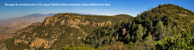
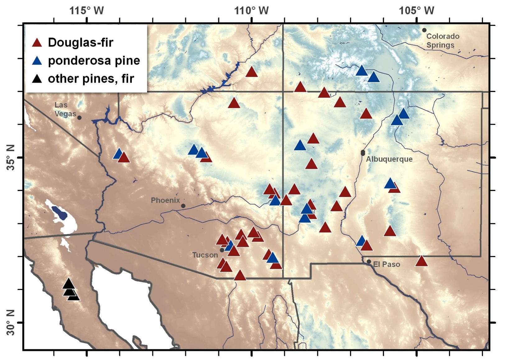
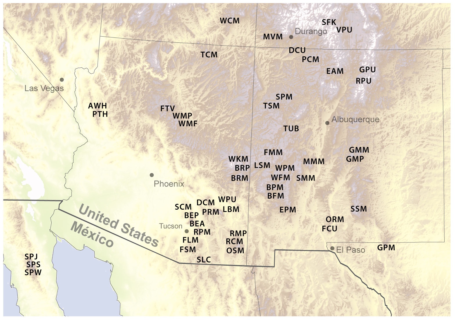
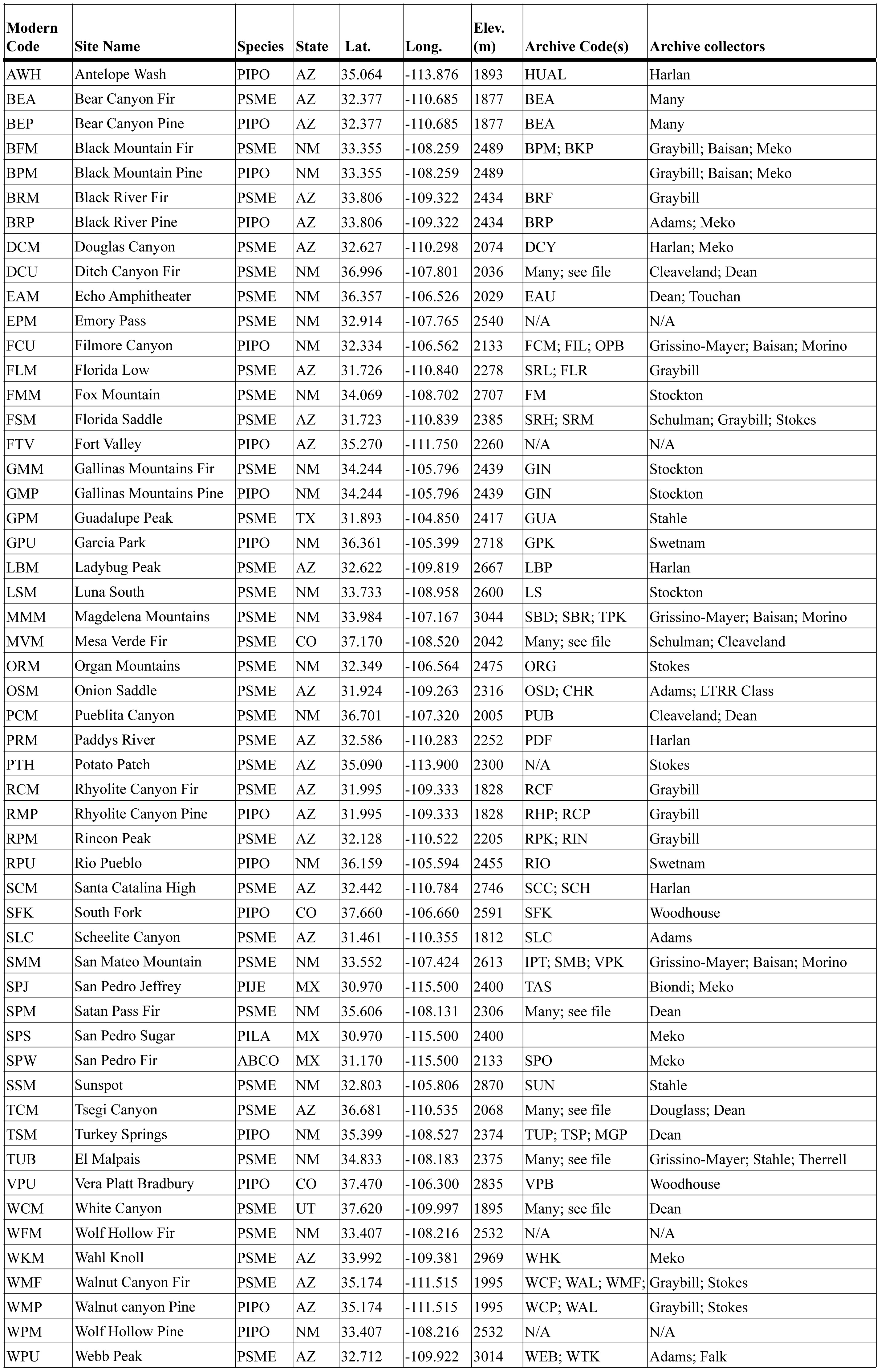
Investigating North American Monsoon Variability in the Southwestern USA using Instrumental and Tree-Ring Data

Tree-Ring Sites
Here are maps and a table listing the tree-ring collection sites analyzed in this project. The first map illustrates the species distribution and location. The second map shows the three letter code and approximate location, as listed in the table below.


The table below lists metadata for each sampling site, including the three letter site codes, the full site names, species codes, location information, and site codes and original collectors for the archived speciemns used to extend our new chronologies back in time. PIPO = ponderosa pine; PSME = Douglas-fir; ABCO = white fir; PIJE = Jeffrey pine, and PILA = sugar pine (PILA).

Home | Background | Documents & Data | Sites | Links | About